Posts

Vrhnika

Where to in Slovenia features micro locations for mobile photographers. Sometimes it is quite a challenge to define “micro”, especially in the cases like Vrhnika, a relatively big city which doesn’t provide many good photo spots in the city area itself. Vrhnika is located in Central Slovenia region on the western edge of Ljubljana Marshes and it is one of the destinations included in the photo contest by Visit Ljubljana. Its green landscape is shaped by Ljubljana Marses, surrounding hills and Ljubljanica river which has many sources around Vrhnika and characterizes the area.

This time we decided to put the “Vrhnika” geo located photo spot on the slope of the Grča Hill just above the city, more precisely to the location of the Monument to the Fallen in the National Liberation Struggle.

It is pretty easy to find one of the many sources of the Ljubljanica river in Močilnik, there is an exit just at the first turn when the road begins to ascend above Vrhnika towards Logatec. Find a path at the corner of the small parking place before the bridge and follow it for some 10 minutes to reach the monument.

The view of the city and the surrounding Ljubljana Marshes is fantastic especially in the early morning when the marshes are covered with mist and the sun is rising.

Unfortunately many trees cover the scenery so for the better view one should climb the monument itself. Or shouldn’t?

We are dedicated to mobile photography but this spot demand some serious landscape settings – even with a beast like HuaweiP20Pro you would need to use a tripod at least.

In that case you can also play with the lights on the busy road through the city.

Obviously we haven’t had one but we managed to capture the church of Sv. Trojica (Holy Trinity Church) from afar.

It is an iconic place of Vrhnika, find out why in the link.

The Močilnik source can be beautiful when it is full of water but not really photogenic. Maybe something can be done with the church on the cemetery over the fields.

Crossing the bridge at Močilnik you can easily reach another area with Ljubljanica springs – the Retovje. The bridge can be photogenic there when the water supply is high and some motifs from the river itself are worth considering a try.

When finished here in the early morning just enough time is left to catch the morning light at the Bistra Castle which is situated along the road a few kilometres towards Borovnica.

The best views of the Vrhnika area are of course from the Planina summit with a lookout tower.

The ponds at the abandoned brickworks near Verd can also provide for some good motifs along the nice walk around the area.

Text and photos: Zoran Leban Trojar @zokus_gf


Bistra Castle

Where to in Slovenia features micro locations for mobile photographers. Bistra Castle near Vrhnika lies on the southwestern margins of the Ljubljana Marshes in Central Slovenia. Originally it was  a monastery but later became a grand mansion. Both settlement and manor take their name from the clear karstic springs, which issue forth from under the adjacent wooded hillside. Since  1951 the castle hosts the nation’s Technical Museum.

One of the oldest museums in the country has really interesting collections, find out more about them here. We are more interested  in the building itself and the karst source which also provides water for some early industrial objects in the castle’s yard.

Walking around these wooden structures above the Bistra source offer many beautiful motifs, mostly reflections.

The light can be an issue here since the castle is perched under a slope of the hill. Early morning light would be the best but the museum opening hours don’t support this idea in all seasons.

There is also a beautiful garden in front of the castle which is mostly used for different activities at the weddings and other events which are often taking place at this beautiful locations. What is even more interesting for photographers is the typical scenery of the marshes which can be seen next to the castle and its garden.

The morning mist, occasional tree and a horse – can you ask for more?

Enjoy!

See more about photo spots around the city of Vrhnika and Ljubljana Marshes.

Text and photos: Zoran Leban Trojar @zokus_gf

Planina Summit above Vrhnika

Where to in Slovenia features micro locations for mobile photographers. Planina Hill near Vrhnika in Central Slovenia is very popular hiking destinations of the city of Vrhnika and also of  the Ljubljana area. Many different starting points and alternative routes are available for hikers and bikers and the summit is also accessible by car. There is a wooden lookout tower near the lodge…

it is 22m high and offers magnificent views over the Ljubljana Marshes…

… settlements around Vrhnika…

…surrounding hills…

… and in good weather conditions even the Julian Alps with the mighty Mt. Triglav.


However, without conquering the tower the views are limited and from the tower a phone camera alone won’t be enough to capture a good shot. Taking the Kuren trail or driving from Vrhnika brings you to the Kmetija odprtih vrat (Agrotourism) where a similar views are available from much lower height though.

Text and photos: Zoran Leban Trojar @zokus_gf.


Snakes’s Head Fritillary Meadow

Where to in Slovenia feature micro locations for mobile photographers. And we mean micro since this one in Ljubljana Marshes, full of fragile Fritillaria Meleagris, has no name. In fact, we’ve just made it up because we needed one for a location in the marshes where it is not easy to orientate at all. A vast plain which no landmarks, wet meadows full of drainage canals with occasional gravel road which easily ends in the middle of nowhere – and some of those meadows are in the season full of Fritillaria meleagris. 

Therefore in this case we are talking about a seasonal photo location  but the marshes are beautiful in all seasons and opportunities for a great photo are always awaiting even without these fragile lilies.

Entering the village of IG from the direction of Ljubljana find a left turn just opposite to the gas station at the beginning of the settlement. After a few hundred meters the road crosses a small river Ižica (there is another special place along this short river) and after that comes to a crossroads. The meadow we are looking for is between the bridge and the crossroads. Around the bridge is also one of the better views of the village.

The best time to capture the fritillaries is at sunset or sunrise.

Sunsets in the marshes are always beautiful but for the fritillaries the sunrise is even better timing.

These meadows are really wet, especially in the early spring when around the sunrise time could be even a bit frozen. However the flora is full of water drops which add to the photo so better prepare everything needed for the situation like this:

Totally worth getting out of bed early!

Enjoy and don’t forget to check out other Ljubljana Marshes locations like St. Anna, Lake Podpeč and Ižica.

Text and photo: Zoran Leban Trojar @zokus_gf. 


Ljubljana Marshes – Ižica

Ižica is one of the shortest rivers in Slovenia. It is a typical river for the Ljubljana Marshes with a karst source in the village of Ig. We named the spot described bellow by the river since there are no other recognisable features to use.

Coming to the village of Ig from Ljubljana and leaving the buildings behind after a few kilometers there is a road to turn to Iška Loka to the right marked with a road sign Iška Loka. Just opposite of the exit there is another one to the left, unmarked and pretty narrow. Turn left and park right away on the left side or proceed on the gravel road until it turns right and park there.

This gravel road is pretty empty most of the time, sitting in the middle of the fields and wet meadows. The landscape is full of lonely trees and the nature is full of life in any season. Flat land, black soil, green meadows, occasional water in the canals make a special feeling which changes with the seasons and is the strongest in the mornings and evenings.

The landscape itself is pretty photogenic. The flora of the marshes is specific and in some seasons the meadows are full of blossoms.

Specific for the marshes is the Snake’s head fritillary from the lily family. It can be easily spotted here but there is another place upstream of Ižica where plenty of them are to be found.

At the turning point of the gravel road just continue in the same direction as you came from. There is no beaten path, just cross the meadows until the river can be spotted after a few hundred meters. The approach to the water changes with seasons and weather but one or two can be easily found.

The meadows. The flora. The water. Upstream. Downstream

The trees. The sunrise.

Take your pick.

Take photos. Enjoy in nature. Check out some other spots on the marshes: St. Anna, Lake Podpeč and Snakes’s Head Fritillary Meadow.

Text and photos Zoran Leban Trojar @zokus_gf.

More about Ljubljana Marshes.

Boka Waterfall and the bridge over the Soča River

Let’s get some facts in the perspective first: Boka waterfall is a 144 high and 18 wide waterfall, considered to be one of the most magnificent waterfalls in Europe. It is definitely the most majestic waterfall of Slovenia and we have plenty of them here. Surely many would disagree if they were not lucky to see it in its full season when its water flow rate can reach 100m3/s. In the summer it can drop to only 2m3/s, so the seasonal flow rate ratio is 1:50! Not this summer though!

The waterfall from the bridge over the Boka stream

The waterfall is visible already from the bridge over the Boka stream in the vicinity of which most of the visitors park their cars and bikes. However, just behind the corner lies the Boka Hotel with its own parking lot which is sooo close to the another bridge, one of the only few bridges over the mighty Soča river itself. The famous shots of the kayakers on the translucent water are usually taken from the Napoleon Bridge in Kobarid – and from this one which  leads to the small settlement of the Log Čezsoški, one of the few settlements on the left bank of the river.

Towards Bovec

We were not lucky with the kayaks this time but the river itself is always beautiful and the view from this bridge is different from what we usually see in the media: it is an upstream view towards the town of Bovec and surrounding peaks of Julian Alps which just after the town divide the upper Soča Valley (Trenta) and Koritnica.

Mt. Bavški Grintavec in the background

There is even more to it – the waterfall is visible from this bridge too and the sight is even better! So if in a hurry a photo can be taken from the bridge – with a good camera it should be decent enough for a memory or a social media post.

Boka from the bridge over the Soča river

Our posts are focused on the mobile photography trying to show places where ordinary tourists can get decent photos without an expensive gear from the reachable spots. We have been doing Instagram and blog for almost 6 years now using phone cameras exclusively.  Ever since we have begun to use HuaweiP20Pro our horizons are widening – it has extremely powerful zoom which can be used handheld: the photo bellow is a zoom up from the same spot as the above photo was taken.

Zoom in from the bridge – amazing zoom of HuaweiP20Pro


After passing the hotel building and crossing the road just before the bridge a narrow path opens leading to the viewpoint which is accessible in some 15 minutes. It is not difficult but we would still recommend to wear a pair of decent shoes. Walking along the bed of Boka in the summer one can imagine the amount of water which flows here when the snow of the Kanin massif begins to melt (up to 8 m of snow can be accumulated in some winters there).The karst terrain with large caves can be deadly for skiers leaving the official ski runs.

The Boka stream bed

The path leading to the viewpoint is mostly in a pleasant shade of the trees with only some tricky places to watch your step.

Pleasant shade

The viewpoint is situated on the slope across the waterfall and can be pretty crowded but the views are much better than from the bridges.


The viewpoint view

Zoom in from the viewpoint

Most of the visitors turn around here but some other viewpoints can be reached which are higher on at the slope and a bit closer to the waterfall. Reaching them is not so easy anymore, the path gets pretty steep and can be slippery as well. We needed another 15 minutes to the next viewpoint following the orientation signs on the rocks and trees.


Orientation signs

Some unexpectedly good sights of the valley towards Bovec awaited us on the path.


The Soča Valley towards Bovec

The water is collected in the karst cave system and spring just above the waterfall, falls freely for 106 m, followed immediately by another 30m drop. The source is situated at an altitude of 725 m, the average temperature of the water is 4,5 degrees Celsium. Since the rock is pretty soft the waterfall  still increases!


Standing closer 

Watching this power of nature from the higher and closer viewpoint and without disruptions from other people is definitely worth all the effort!


Zooming in again

Returning on the the mountain paths is always more dangerous than going up so be careful stepping down! But don’t overlook this sight with which this whole short photo trip can be rounded up: the road to Log Čezsoški.


Left bank of the Soča river towards Log Čezsoški

Of course we had to check the situation on the bridge again when we returned to the parking lot.

Preparations

Some more luck though but not the proper light to get the effect of the kayaks hovering on the water.


From the bridge

Nevertheless this bridge offers excellent up and downstream views on the river and the valley caught amidst the steep mountains and it is worth to stop there for the bridge itself. The sights are ever changing.

Downstream view towards Žaga

Hey, there is some shadow underneath the kayak after all:)

Photo and text by @zokus


Krma Valley

Krma is a glacial valley, one of the three valleys that stretch from bellow Mt. Triglav to the village of Mojstrana. Krma is the southeast of them and probably best known as the easiest access to the Triglav peak.  There is a  route to the Triglavski dom lodge which is 7,3 kilometres long and  gradually ascends 1550 height meters.

Krma Valley is the upper part of a Radovna Valley which ends near Bled with the famous Vintgar Gorge. In fact we were exploring the Radovna Valley in the morning  and out of curiosity turned onto the gravel road leading to the Krma Valley at the crossroads for Mojstrana. When the road came out of the forest and we got the first glimpse of the mountains surrounding the valley there was only one thought on our minds: to stop the car as soon as possible too see it in full.

It was still early in the morning, the sky was blue with some puffy clouds showing over the peaks, the valley was empty.

rhdr

Krma is also known as a mountain pasture but as we have learned latter the cows were only to come next week.

Soon the clouds made some more drama over the peaks but it was still pretty warm outside in the front of Kovinarska koča lodge where we ordered some sweet dumplings for breakfast.

The Krma valley is a great place to have a walk or stay a few days in silence hiking around. It is accessible also in winter. The Krma route to Mt. Triglav is the safest one in the winter and offers some great ski touring slopes. The scenery provides for magnificent photos in all seasons.

Posted and photographed by @zokus_gf.

Entering the city with Ljubljanica river

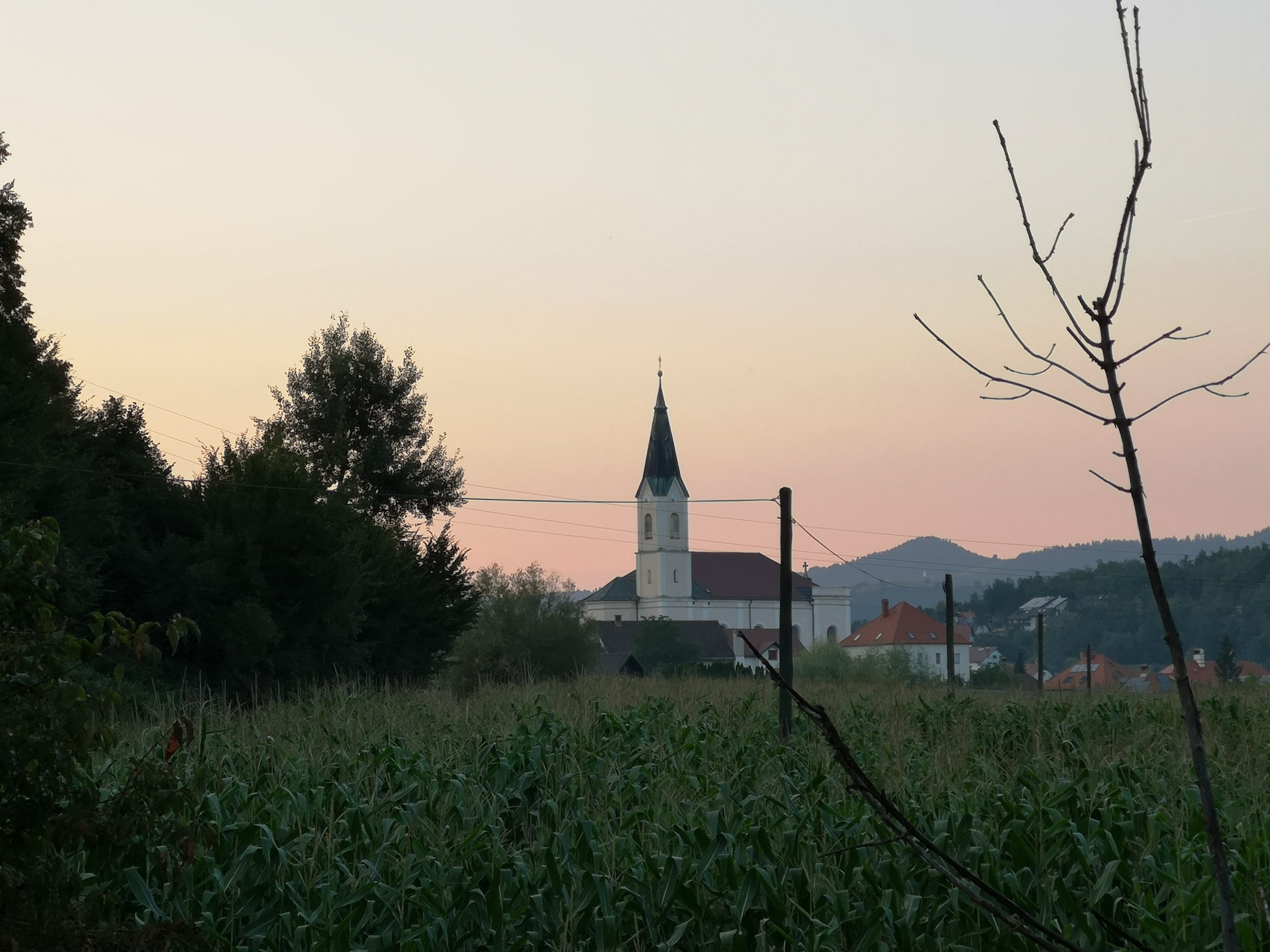
Sometimes the Ljubljanica river is  called The River of Seven Names due to its karst nature –  on its way towards Ljubljana disappears underground several  times and springs again at different places, every time under a different name. Even as Ljubljanica has a number of different springs.  Ten kilometres to the northeast of Ljubljana city centre it empties itself into the Sava river. It is one of the most notable landmarks of the city or even more – it is the foundation of the city itself.

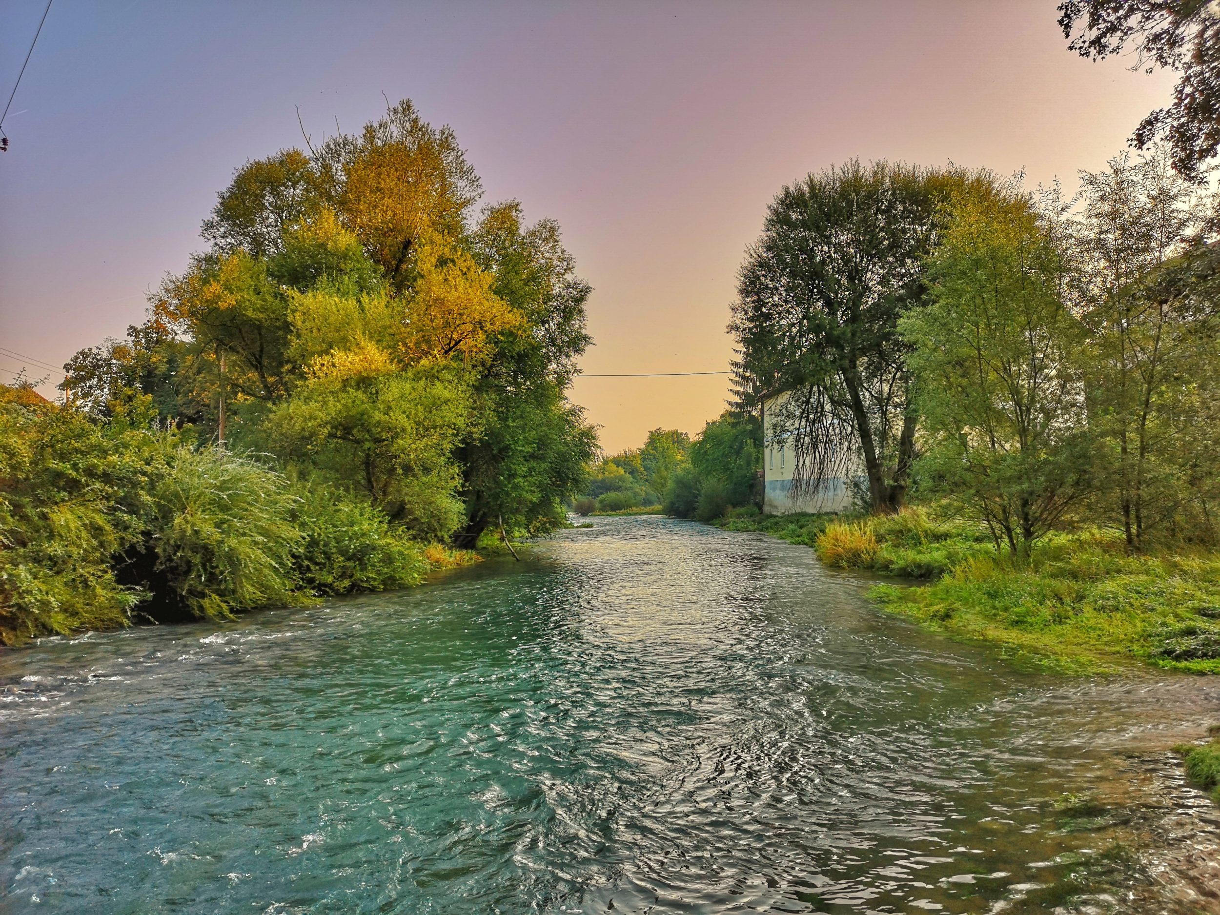
Upstream view from Livada but it could be anywhere – from Vrhnika to this spot looks more or less the same.

From Roman times to the construction of the railway in the mid-19th century, the Ljubljanica was a major trade and supply route. Romans even moved its bed to in order to bring the stones for building purposes from Podpeč at Ljubljana Marshes.

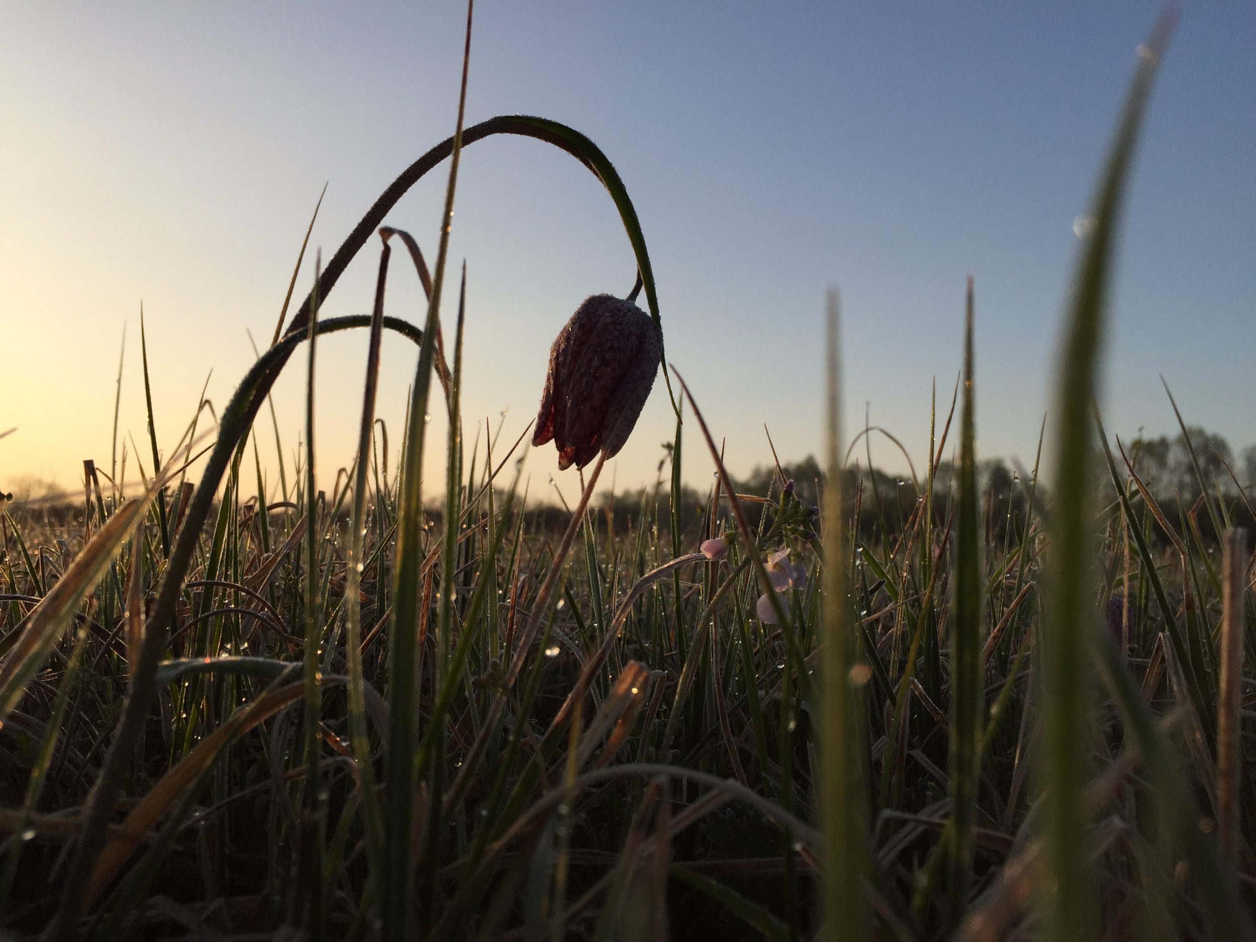
On its way to Ljubljana, the river flows through the unique natural landscape of Ljubljana Marshes and descents only 1 m in its 20 km lenght. Its bed is one of Slovenia’s most important archaeological sites. Excavations have yielded objects dating from prehistory to the early modern period. Archaeologists believe that the river once had a cult status. In April 2002 archaeologists found the remains of a two-wheeled wooden cart dating 5100 to 5350 years back into the past. It is the oldest wheel found in Europe and elsewhere in the world so far. The wheel is on display at the City Museum of Ljubljana.

But Ljubljana Marshes is an  another story which is to be covered elsewhere. Here we just want to suggest an interesting photo walk along and around the river where it enters the wider city centre. The whole path is just around the corner of the city centre itself yet most of the time it feels like another world.

View towards the city from the bridge at Livada

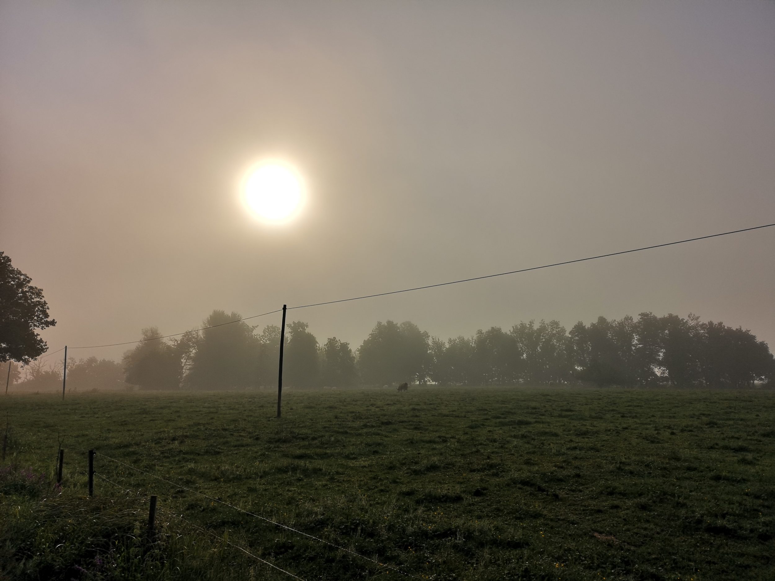
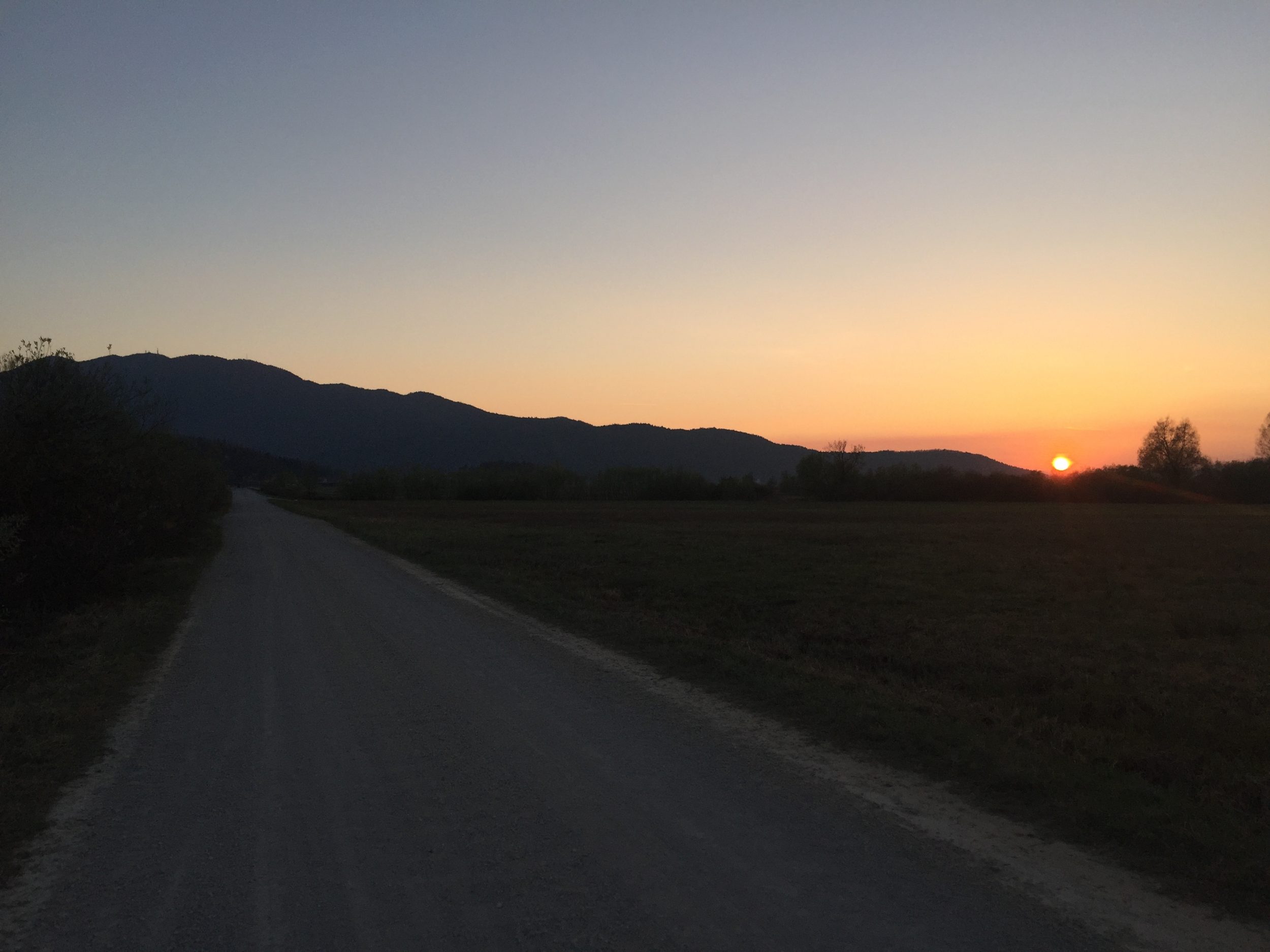
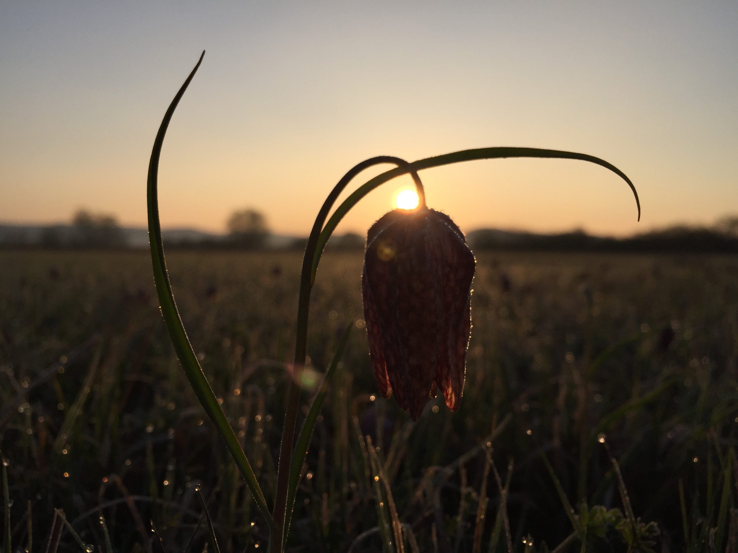
It is possible to start the tour at any end or make a circle – it will take around 90 minutes. We have started at the bridge near the restaurant Livada at sunrise. Ljubljanica is beautiful in all conditions but we love the early morning light.

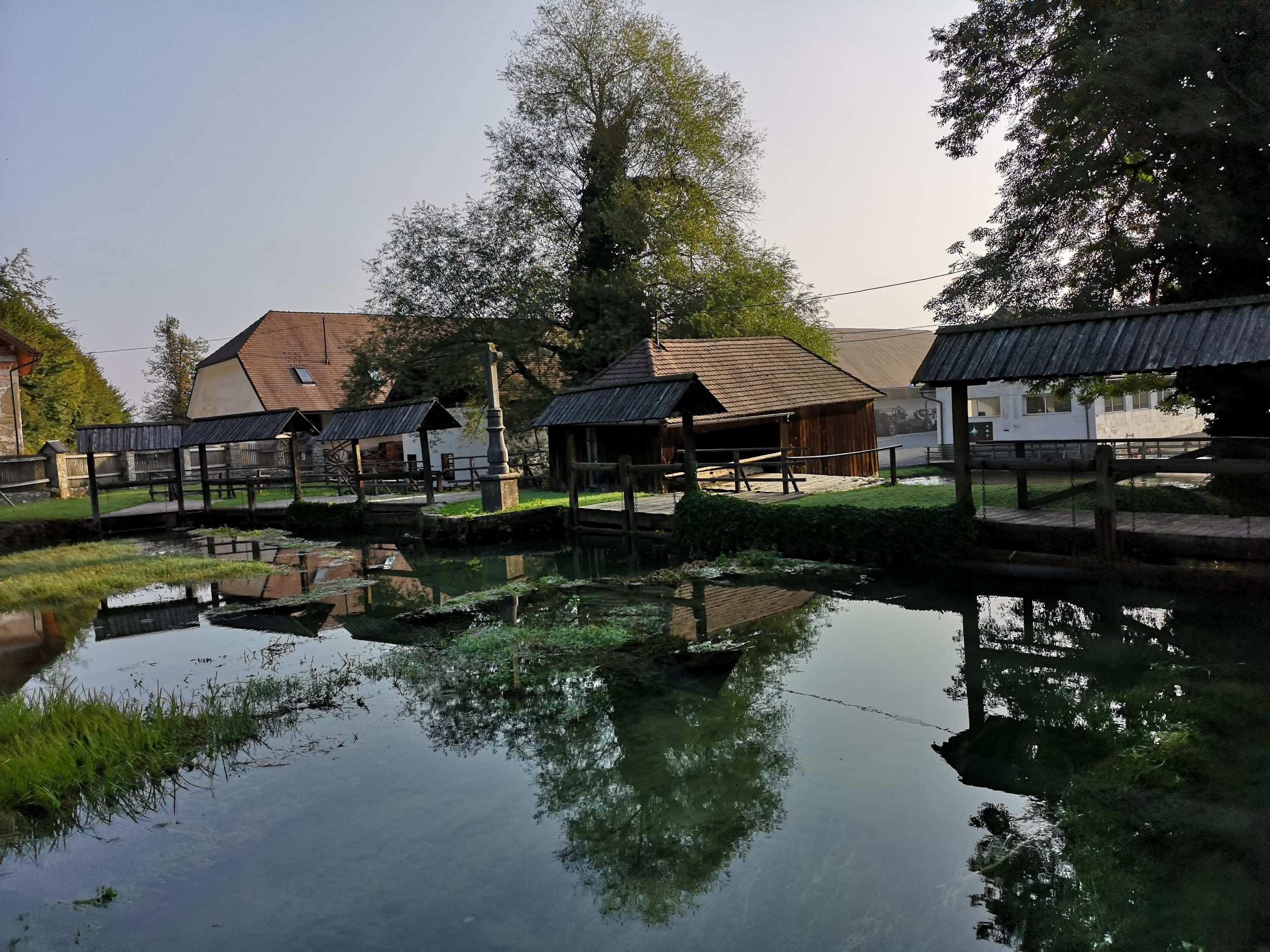
On the left bank just at the bridge is located Fishing Club Barje and a number of small vege gardens. It is necessary to navigate between them to find the access to the water and a scenery like this:

Left bank just under the bridge.

There are some more points where the river can be reached further down the left bank but pretty complicated to find them since one has to go to Opekarska street (Opekarska cesta) and look for the passages between the buildings. Another channel of water coming into the river doesn’t help here. In fact it is not worth the effort at all. Crossing the bridge and following the right bank bellow the restaurant or starting behind the restaurant at the Kajak Kanu Club Ljubljana would be a much better idea.

Kayak Kanu Club Ljubljana

Upstream, downstream, across the river – colourful motives are all around. Even an old school boat was modelling for us!

Designed to win

Upstream view was also pretty nice.

Kayak Kanu Club upstream view

After the fence which closes the Kayak Kanu Club premises access to the water is again limited so a slight detour is needed here – exit the premises to the Livada Street and turn left onto Ižanska cesta just to turn left again after some 200 meters behind the educational complex which can not be missed. This should be a reassuring view confirming  you are on the right path:

Hladnik Bridge

Hladnik’s Footbridge connects the city with a green suburban area and  the  Ljubljana Botanic Garden, which is just across the street of Ižanska cesta. Špica is awaiting on the other side of the bridge, a renovated Ljubljanica river embankment landscaped as a park. Špica used to be a city beach. Now again, due to its green surroundings and a large area paved with wood, it  attracts numerous visitors.

Špica – only a part of the refreshment areas.

Špica translates as a “pointed tip” due to its shape which splits Ljubljanica in two channels – the left turn flows into the city centre while the right one goes around it. It is called Gruberjev Channel and it was build in order to add more descent thus helping the city with high waters and floods. The bank was recently renovated and new wharfs were added to improve the look and feel of the river.

Gruber channel and the wharfs.

From Špica it is possible to reach the city centre walking along the river almost all of the time. Here the river says farewell to its slow and dreamy natural appearance…

Looking back into the wild nature at Špica

… and gets more urban. The transition is smooth…

From Špica to the city

…but definite. First traffic bridge is only 200 meters away and from it the  distinctive appearance which the river owes to the architect Jože Plečnik, who designed the old city centre’s river embankments, landscaped tree-lined riverside walks, including the well known weeping willow-lined terraced walk alongside the Trnovski pristan embankment.

View to the Trnovski pristan embankment

Crossing the bridge you can continue along Opekarska Street and turn left at the traffic lights to reach the starting point at Livada or turn right to enjoy the willow-lined walk to Trnovski Pristan. The walk along the river through the city centre is described in another post.

Looking upstream from Trnovski Pristan – it is beautiful in any weather!

All photos are made with HuaweiP20Pro in cooperation with Huawei Slovenija.

Zoran Leban Trojar @zokus_gf

Ljubljana (from Trg revolucije to the Town Hall)

Ljubljana is a small city by the standards of capital cities but just as Slovenia itself it offers  many great views at the short distances. Since we are dedicated to show you not only the obvious few spots of Slovenia we decided to divide descriptions of Ljubljana to shorter walks which offer great photo opportunities.maximStarting point is Trg Republike (Republic Square). It is the centre of contemporary Ljubljana built in 1960 by famous architect Edvard Ravnikar and  surrounded by the Parliament (just behind my back), Cankarjev dom – cultural and congress centre, Maximarket department store and TR3 and Ljubljanska banka office buildings (on the photo). All building were built between 1954 and 1975  and that’s why I call the square “contemporary”. Until a few years ago it used to be a parking space. Now, when empty, these two buildings stand as a kind of entrance (or exit). Since the square itself is fairly empty it offers fine but tricky photo opportunity.The square and the buildings are huge and the sunlight comes mostly from behind of Maximarket or the towers. See it for yourself. In the late autumn sun sets just between the towers.


ursulinskaUrsuline church and monastery are just a passage of Maximarket store away – facing the towers just turn left. Too close in fact to find enough space for a proper shot. The church tower is also visible from the Republic square over the roof of the store and from some side views, but always just partially. But if you turn left again and use the underground passage just a few steps away you’ll find yourself in a fine park of Kongresni trg (Congress Square). Now, on your right, is a front side of the same church from 1726.

ursulinkskafrontThe concrete part of the square where you stand now also used to be a parking lot but now offers a clean view on the magnificent Ljubljana Castle over the building of Slovenian Philharmonic, one of the oldest of the kind, from 1701. Just behind your back, taken from the steps of the church.

gradThe beautiful park itself is also called Zvezda (Star), in past times also Sidro (Anchor). Just take a stroll and you find the reason for yourself.

zvezdaMany different approaches are possible now to the river bank, personally I prefer  the narrow one beside the Philharmonia building.

filharmonijaFrom the From the other side, back to the square, it is possible to catch a sunset a few days around late spring. But in the autumn the view on the river, old city buildings and the castle is enriched with large leaves.

listgradOn your left is now the famous Tromostovje (Triple Bridge) with the Franciscan monastery and the Church of the Annunciation in the background.

Early morning view in early summer of 2018.Taken with the HuaweiP20Pro.

It is probably one of the most photogenic spots of Ljubljana – it always looks great, different angles and different weather/light conditions just provide for different mood. Almost like Bled Island and Church of St. Primus and Felician at Jamnik. One of the best is from the new small bridge or from Makalonca bar just bellow the bridge.


tromostovje

Especially in the season one has to be pretty early to catch the spot without crowds.

Tripple Bridge and the Church of the Annunciation. Taken with the HuaweiP20Pro.


The best view on Prešernov trg (Preseren Square) in the front of Triple Bridge is from the steps of the Franciscan Church of the Annunciation, the red building on the photo above. It is difficult not to catch at least a glimpse of the castle from spots around here.

presernovCrossing the Tripple Bridge you’ll find yourself in front of the Town Hall and famous baroque Robba Fountain with a view on the Cathedral.

magistratEarly morning is always the best time to take photos around here since sun rises somewhere behind the castle, exact point of course depends on the time of the year. Daily sun can be very harsh and  the whole area is already in the shadow afternoons.

For more information about the sights and Ljubljana Visit Ljubljana, one of the best tourist websites and offices in the world.


Zoran Leban Trojar @zokus_gf

The best of 2017

Another great year behind us! A number of workshops and lectures with companies and tourist organisations, a big joint venture campaign with Visit Ljubljana to promote Central Slovenia, two Instameets we have organised at home and two we joined in Croatia, next one already in January at Plitvice Lakes! Our @igslovenia community still growing and engaging is what gives us a satisfaction and pays for hundreds of hours spent to bring you the best photos from as various locations of Slovenia as possible.

So, The Best Of … Lets’s start with the best nine photos by number of likes. What comes as a small surprise is that all nine are from different artists given the fact that more than 50 photographers were featured more than once in 2017 and fifteen of them were featured five or more times. So here we go, from left to right and top to the bottom (all Instagram handles and links, more or less all of them also have a Facebook account which you can find): Jošt Gantar @jostgantarEmmet Sparling @emmet_sparlingAndrea Papazzoni @andrewpapaLuka Esenko @lukaesenkoIztok Medja @iztok_medja@roamarooStephen Barna @barnadriftJani Peljhan @janipeljhanDragan Gavranović @photocorax.

IMG_8699

Our selection of the year is in fact not a selection at all since we just counted the number of features by the artists. On the other hand this number of course reflects our selection through the year. We are trying to feature high quality photos of different locations and not to repeat a single photographer too many times. But just as it happens with photos of Bled – throughout the year we post many of them and some photographers get more features than others simply because they are highly active and post different locations of superior quality.

There are 16 of them who got at least 5 features, 8 of them more than five. Please note that photos used here are screenshots from Instagram only and that they not necessary corresponds to the actual featured photos on our profile.

Jošt Gantar @jostgantar is the artist with the most features of all.

IMG_8688

In the next group very close to Jošt are:

Luka Esenko @lukaesenko:

Around Logatec

Around Logatec

Ana Pogačar @anapogacar:

Homec near Kamnik

Homec near Kamnik

and Jaka Ivančič @jaka_ivancic

Piran

Piran

Next group with the approximate same number of features consist of:

Katarina Veselič @katarinaveselic

Bled

Bled

Gregor Škoberne @gregorskobernephotography

Bohinj

Bohinj

Aleš Krivec @dreamypixels

Vršič

Pokljuka

and Nejc Suhadolnik @neworx

Krn

Krn

Eight photographers were featured exactly five times each.

Peter Zajfrid @peterzajfridphoto

IMG_2920

St. Ana, Brezovica

Iztok Medja @iztok_medja

IMG_2921

Vršič

Andrej Tarfila @andrejtarfila

Sorško polje

Sorško polje

Dani Turnšek @daniturphoto

Pristava, Cirkulane

Pristava, Cirkulane

Dani Kla @dani.kla

Bled Island

Bled Island

Uroš Abram @uabram

Jamnik

Jamnik

Luka Kotnik @lukakotnikphotography

Piran

Piran

and Jan Čermelj @jancermelj.

St. Jakob

St. Jakob.

We thank you all for participating, tagging and engaging. Love you all,

Sanja and Zoran